Forty Miles of Byway, One Way, in Late March
A byway is only as good as its pull-offs, and this one has more than most drivers use. I left at one o'clock and drove forty miles of the old road east from Charleston on the last Tuesday in March. The plan was one direction out, with stops wherever the shoulder allowed a safe turn. Coming back I ran the same pavement without stopping, which is a different road entirely.
This is the road people used before the interstate, and it still follows the river. It threads river towns, rail lines on the far bank, and hillsides that close in slowly. In late March the valley is halfway dressed, with redbud open and the oaks still bare. That gap between the early bloom and the late leaf is the whole reason to go now.
Nothing here asks for a hike, though two stops put you on wet stone for a few minutes. The driving is the trip, and the walking is a stretch between stretches of driving.
The first fifteen miles
The road leaves the east side of Charleston as a four-lane and gives that up quickly. Through the first towns it runs two lanes with a curb, a sidewalk, and frequent lights. Speed drops to thirty-five and then to twenty-five, and the pace is set by whatever is ahead. I made fifteen miles in thirty-two minutes, which sounds slow until you see what is out the window.
The river stays on the right the whole way, wide and slow and the color of weak coffee. Rail lines run the far bank, and long strings of cars sat still for most of my drive. Barges work this water in strings of three or four, pushed by boats that never seem to rush. Above the towns the hillsides rise fast, with houses stacked on shelves cut into the slope.
Pavement through this stretch was patched and rough in the wheel tracks near the curbs. The state had swept the winter grit, and the sweeper lines were still visible in places. Two towns had crews working the shoulders, with flaggers and a short wait each time. Neither delay ran past four minutes, which is nothing in a trip built around stopping.
Where the valley closes
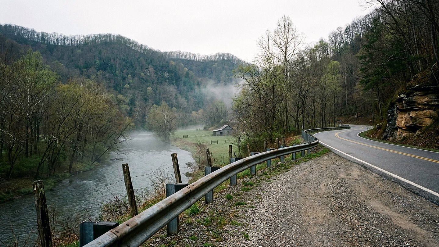
Around mile twenty-eight the hills start to squeeze and the road loses its straight sections. The river narrows, the far bank climbs, and the rail line gets pushed right to the water. Curves come in pairs here, and the posted advisory speeds drop into the thirties. Every one of them is a good curve if you have no reason to be anywhere soon.
By mile thirty-three the valley is a proper gorge with rock showing on both sides of the water. Sun reaches the road late in the morning and leaves it early in the afternoon. That is why frost holds in the shaded corners well into April along this stretch. I hit one damp patch under a rock face and felt the truck take a half step sideways.
At mile thirty-six two rivers come together and become a third one under an old bridge. The falls just below that meeting are wide rather than tall, a shelf across the water. There is a pull-off with room for perhaps eight vehicles and a view straight down the drop. I gave that stop twenty minutes and could have given it an hour without running short.
The pull-offs that work
Not every wide spot on this road is a stop, and some are just failed driveways. The ones that work have a flat apron, a clear sight line back, and somewhere to stand. I used four of them in forty miles and passed maybe a dozen more that looked wrong. Backing onto a 55-mile-per-hour road with a curve behind you is not my idea of sense.
The falls pull-off near mile thirty-six is gravel and drains poorly after a heavy rain. A second one at mile thirty-nine sits under a rock face with water coming down a mossy chute. That water runs year around and the spray keeps the lower stones wet and slick. I walked to the base in three minutes and came back with wet boots and no complaints.
Two smaller pull-offs sit in the town stretch and give you the river without any climb. Both are paved, both are level, and both put you within twenty feet of the water. County pages list a couple more that I simply could not find from the road. Markers come up fast in the narrow section, so I missed one turn and did not go back.
What spring does to the hillsides
In late March the green starts at the bottom and works its way up the slope. You can read elevation by color here, which is a thing this valley does very well. Grass along the river was already thick, and the first mowing had been done in town. Two hundred feet up the same hill, the woods were still gray with nothing but buds.
Redbud carries the color at this stage, in patches along the cuts and old fence lines. It reads purple from a distance and pink up close, which never quite makes sense. Dogwood was a week behind and showed only in the warmest corners near the water. Sycamores along the bank keep their white upper limbs and stand out against everything.
The river was up from a rain three days earlier and carried a heavy load of brown. Drift piles had collected at the head of every island and against every bridge pier. Fields in the wider bottoms were too wet to work and held standing water in the low ends. By the middle of April this same drive reads completely different, and I will take it again.
What it came to
The trip ran four hours and fifteen minutes from my driveway back to it on a weekday. Driving covered 82 miles in two hours and thirty-five minutes, counting the lights and the crews. Time out of the truck came to one hour and forty minutes across four separate stops. I was home with about two hours and thirty minutes of daylight left, which March finally allows.
This road does not suit a driver who wants to make time or pass on a whim. Sight lines are short in the narrow miles and the pull-offs are shallow near the rock. Two of the four stops involve wet stone, and one of them stays wet in every season. If that sounds like trouble, run the four-lane and skip this whole valley in comfort.
For everyone else, forty miles of it takes an afternoon and gives back more than it asks. The road has been there a long time and shows no sign of changing its habits.
The count
- Time out of the truck 1 hour, 40 minutes
- Driving 82 miles in 2 hours, 35 minutes
- Daylight left 2 hours, 30 minutes
Checked against
- Scenic byway and route descriptions from the state department of transportation
- County pages listing river access points and roadside pull-offs
- State highway notices on spring sweeping and shoulder work

Wes CardwellFounder and editor. Charleston, West Virginia. Every trip on this site was driven, walked, and timed by hand.